


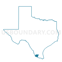
Voting District 0004, Starr County, Texas
About
Outline

Summary
| Unique Area Identifier | 676818 |
| Name | Voting District 0004 |
| County | Starr County |
| State | Texas |
| Area (square miles) | 304.84 |
| Land Area (square miles) | 304.68 |
| Water Area (square miles) | 0.17 |
| % of Land Area | 99.95 |
| % of Water Area | 0.05 |
| Latitude of the Internal Point | 26.66193420 |
| Longtitude of the Internal Point | -98.51695110 |
Maps


Graphs
Select a template below for downloading or customizing gragh for Voting District 0004, Starr County, Texas


Neighbors
Neighoring Voting District (by Name) Neighboring Voting District on the Map
- Voting District 0002, Starr County, TX
- Voting District 0003, Jim Hogg County, TX
- Voting District 0005, Starr County, TX
- Voting District 0005, Brooks County, TX
- Voting District 0009, Starr County, TX
- Voting District 0024, Hidalgo County, TX
- Voting District 0076, Hidalgo County, TX
Top 10 Neighboring County Subdivision (by Population) Neighboring County Subdivision on the Map
- Sullivan City CCD, Hidalgo County, TX (33,306)
- Rio Grande City CCD, Starr County, TX (30,276)
- La Grulla CCD, Starr County, TX (11,600)
- Puerto Rico-San Manuel CCD, Hidalgo County, TX (1,595)
- Encino CCD, Brooks County, TX (463)
- South Jim Hogg CCD, Jim Hogg County, TX (83)
Top 10 Neighboring Place (by Population) Neighboring Place on the Map
Top 10 Neighboring Unified School District (by Population) Neighboring Unified School District on the Map
- Edinburg Consolidated Independent School District, TX (137,053)
- Rio Grande City Consolidated Independent School District, TX (36,386)
- Roma Independent School District, TX (23,556)
- Brooks County Independent School District, TX (7,223)
- Jim Hogg County Independent School District, TX (5,300)
- San Isidro Independent School District, TX (1,026)
Top 10 Neighboring State Legislative District Lower Chamber (by Population) Neighboring State Legislative District Lower Chamber on the Map
- State House District 40, TX (215,412)
- State House District 31, TX (165,121)
- State House District 43, TX (148,370)
Top 10 Neighboring State Legislative District Upper Chamber (by Population) Neighboring State Legislative District Upper Chamber on the Map
Top 10 Neighboring 111th Congressional District (by Population) Neighboring 111th Congressional District on the Map
Top 10 Neighboring Census Tract (by Population) Neighboring Census Tract on the Map
- Census Tract 242.01, Hidalgo County, TX (14,553)
- Census Tract 9504.02, Starr County, TX (5,178)
- Census Tract 9504, Jim Hogg County, TX (3,037)
- Census Tract 9501.08, Starr County, TX (2,818)
- Census Tract 9501, Brooks County, TX (2,042)
- Census Tract 243.01, Hidalgo County, TX (1,595)
- Census Tract 9501.01, Starr County, TX (1,268)
Top 10 Neighboring 5-Digit ZIP Code Tabulation Area (by Population) Neighboring 5-Digit ZIP Code Tabulation Area on the Map
- 78541, TX (42,431)
- 78582, TX (40,455)
- 78361, TX (5,350)
- 78536, TX (451)
- 78353, TX (433)
- 78563, TX (376)
- 78591, TX (265)
- 78588, TX (238)